Catherine Mtn to Hog Bay Run 19km

For the last year, I’ve been meaining to run the 4 local mountains close to my rental house in DownEast Maine. I’ve run up and over Schoodic Mtn many times,
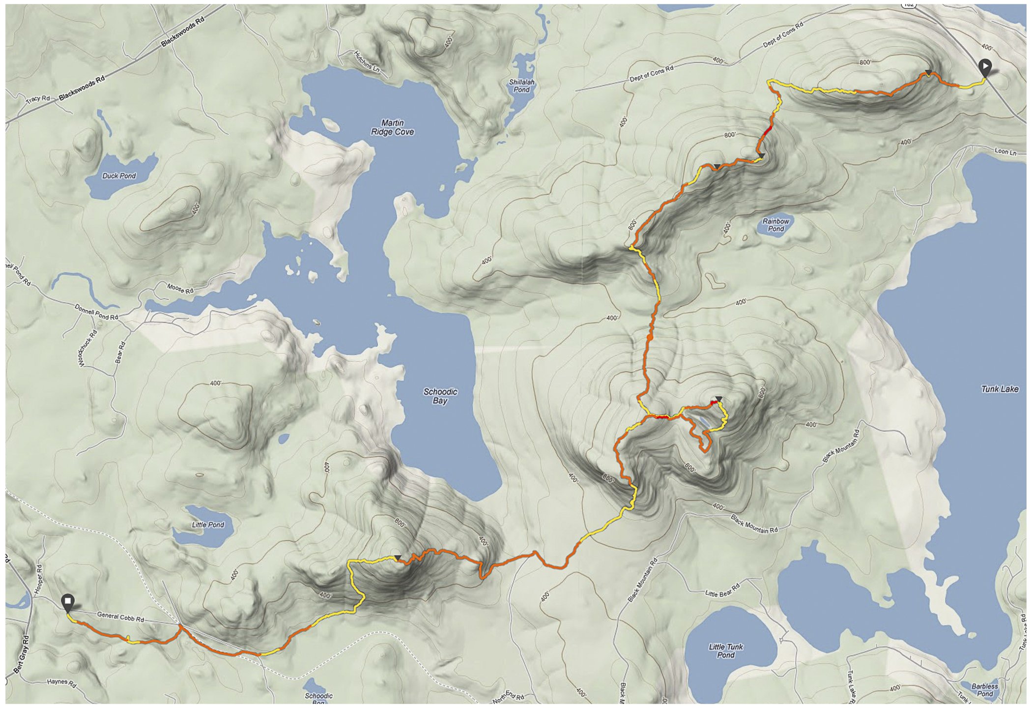
and today, after being dropped off by my wife at the base of Catherine Mountain, I ran all 4 peaks. Here’s the gps track:
TopoMap
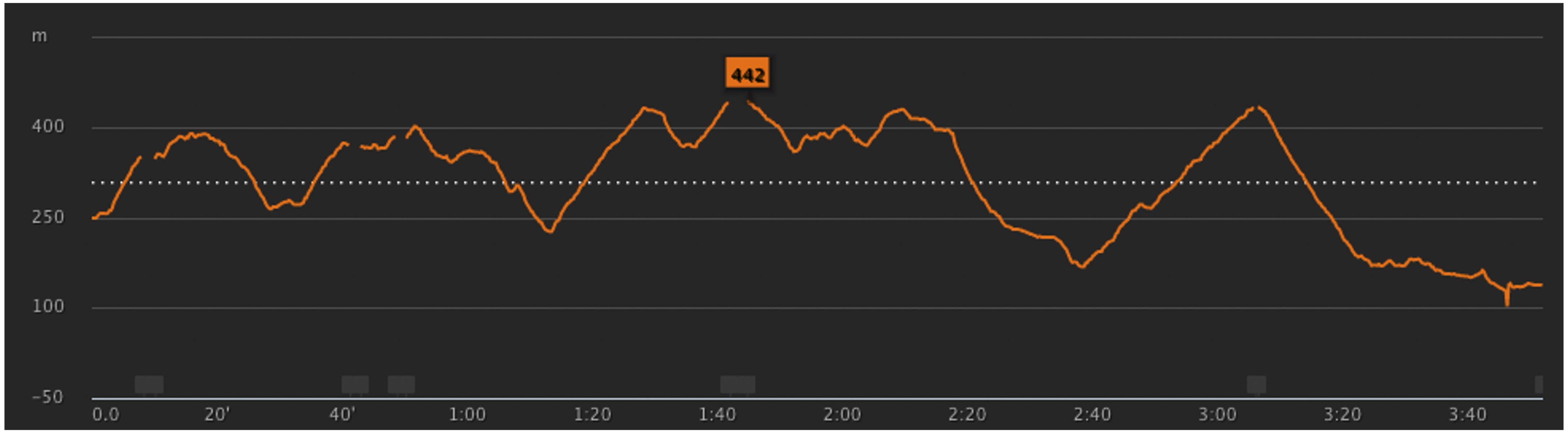
and here’s the elevation profile (absolute height should be lowered by 100 meters since I fogot to calibrate my watch at beginning.):
elevationProfile

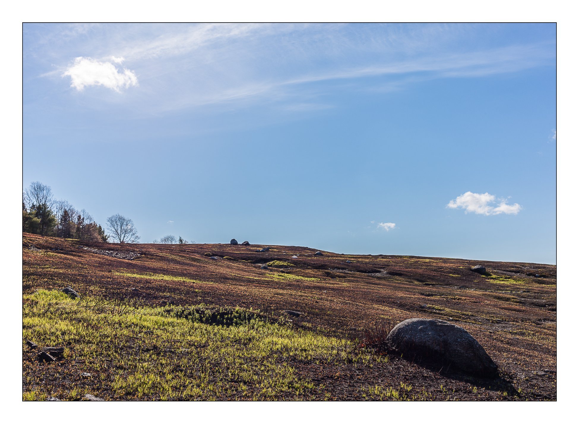
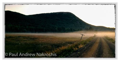
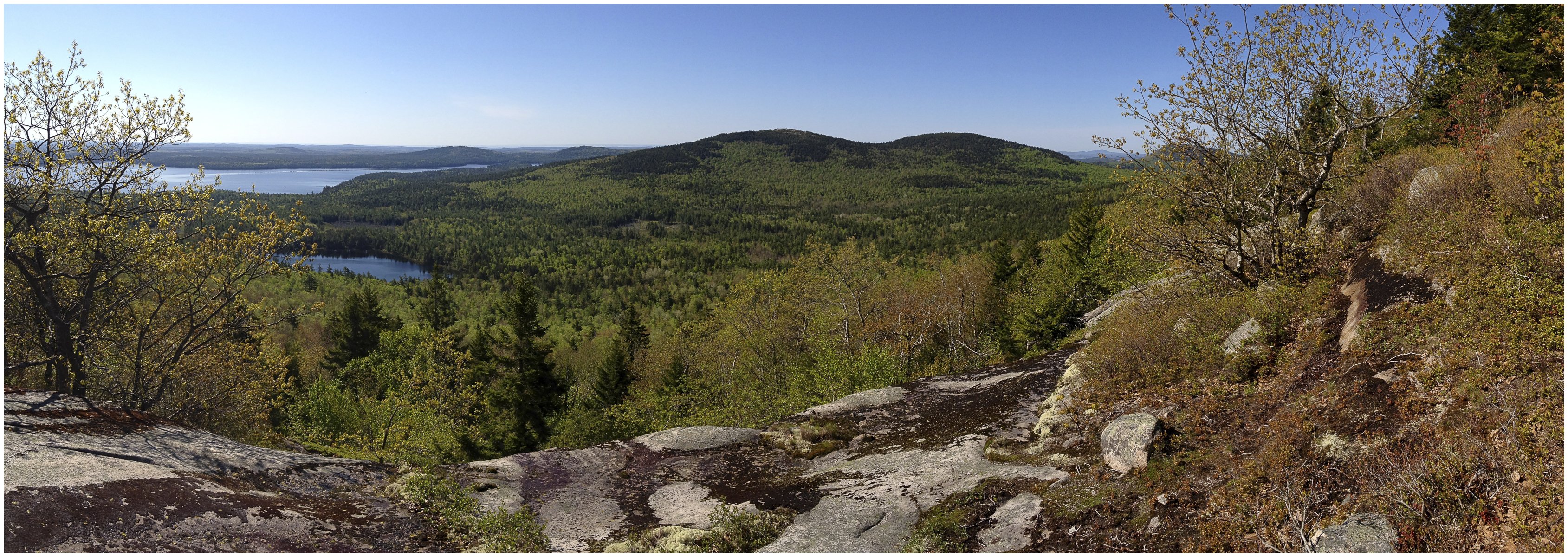
After a week of rain and cold, today was finally a nice sunny day. Got a late 8 am start, ran over Catherine Mt, and then to Caribou Mtn where one has this
view of Black Mountain (with 2 (or 3 depending on your criteria) peaks):
BlackFromCaribou
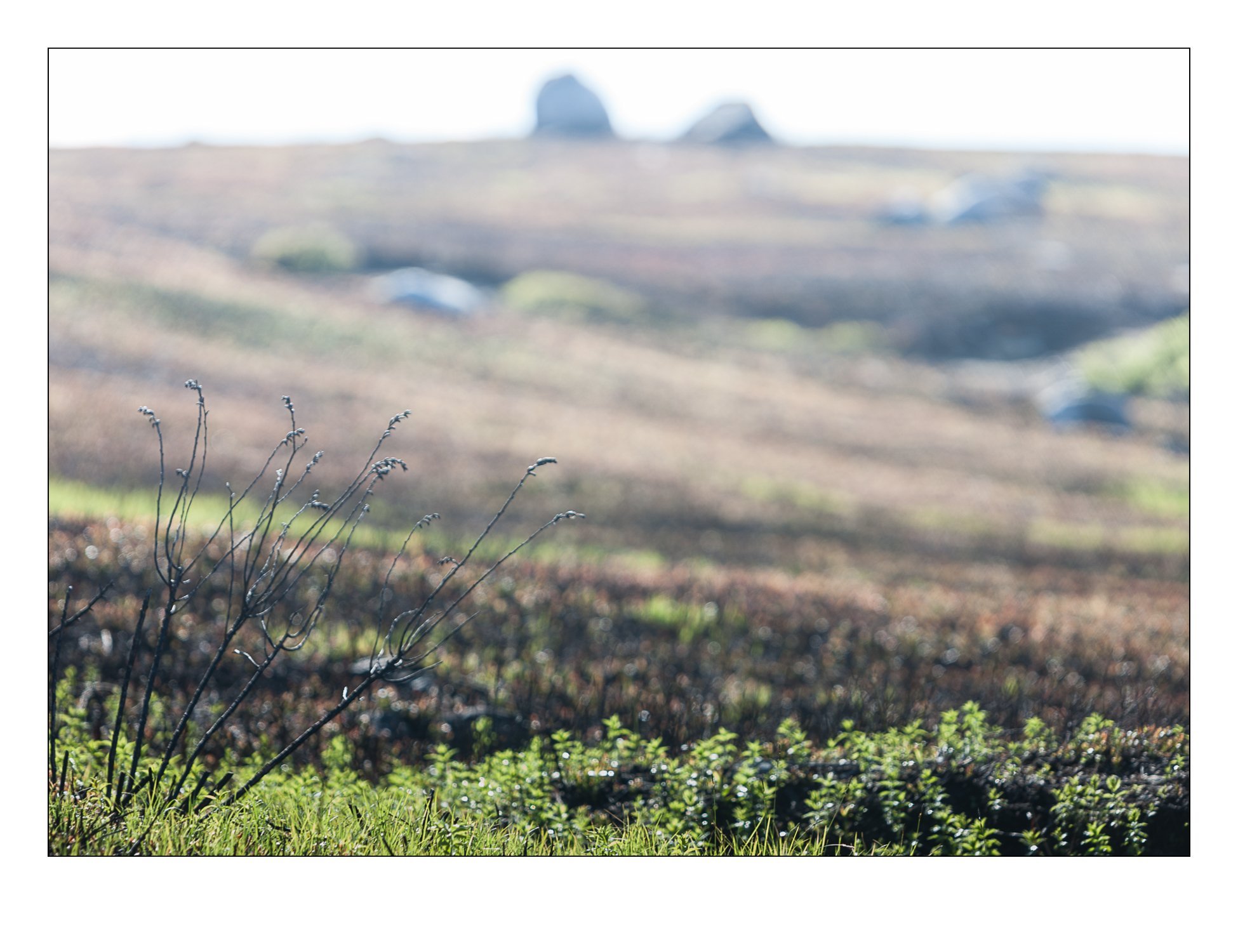
From Caribou Mountain, it’s down the cliffs then down to the valley, and then up to the west summit of Black Mtn (in the woods) and then down to the col and up
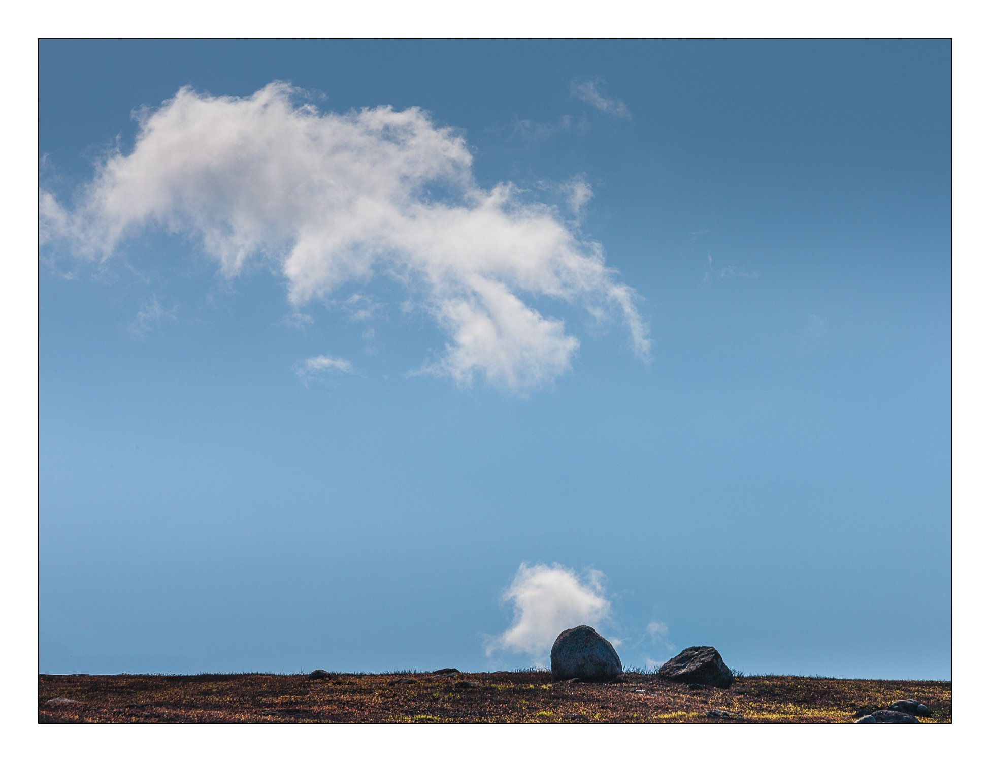
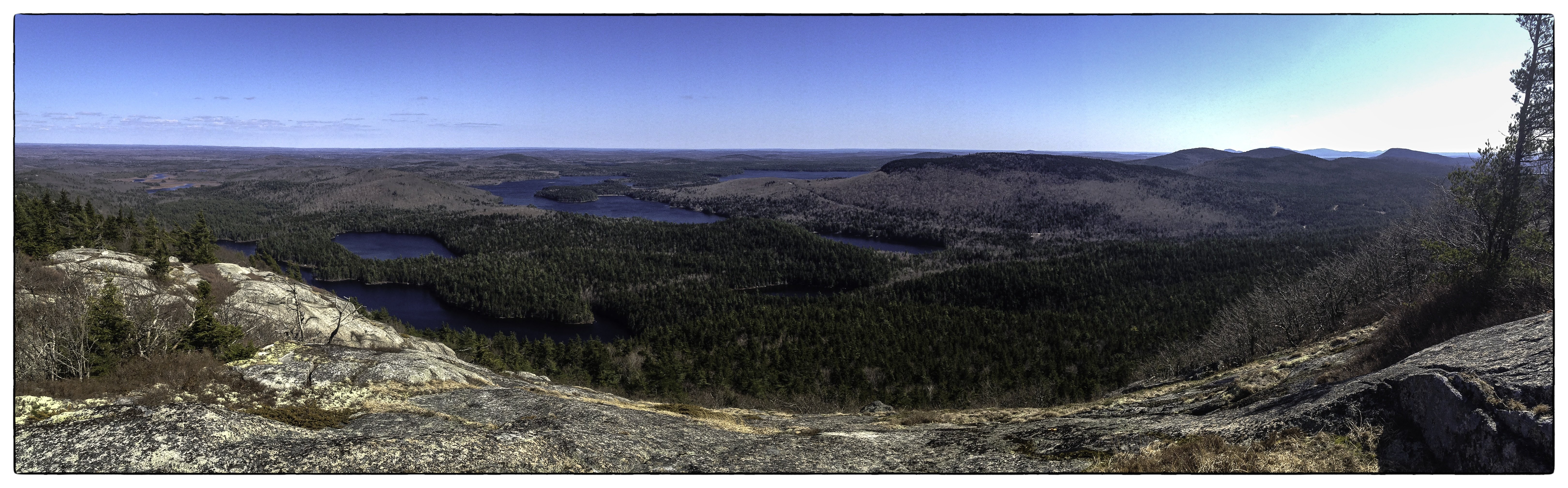
to the bare east summit, which affords a nice view back toward Catherine and Caribou Mtns:
CatherineFromBlack
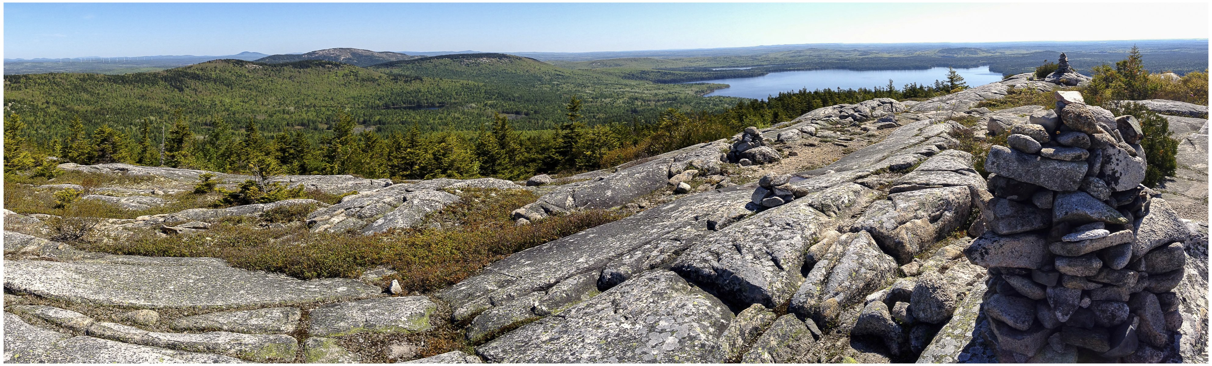
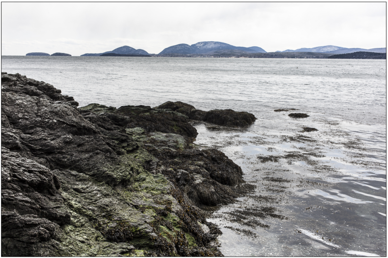
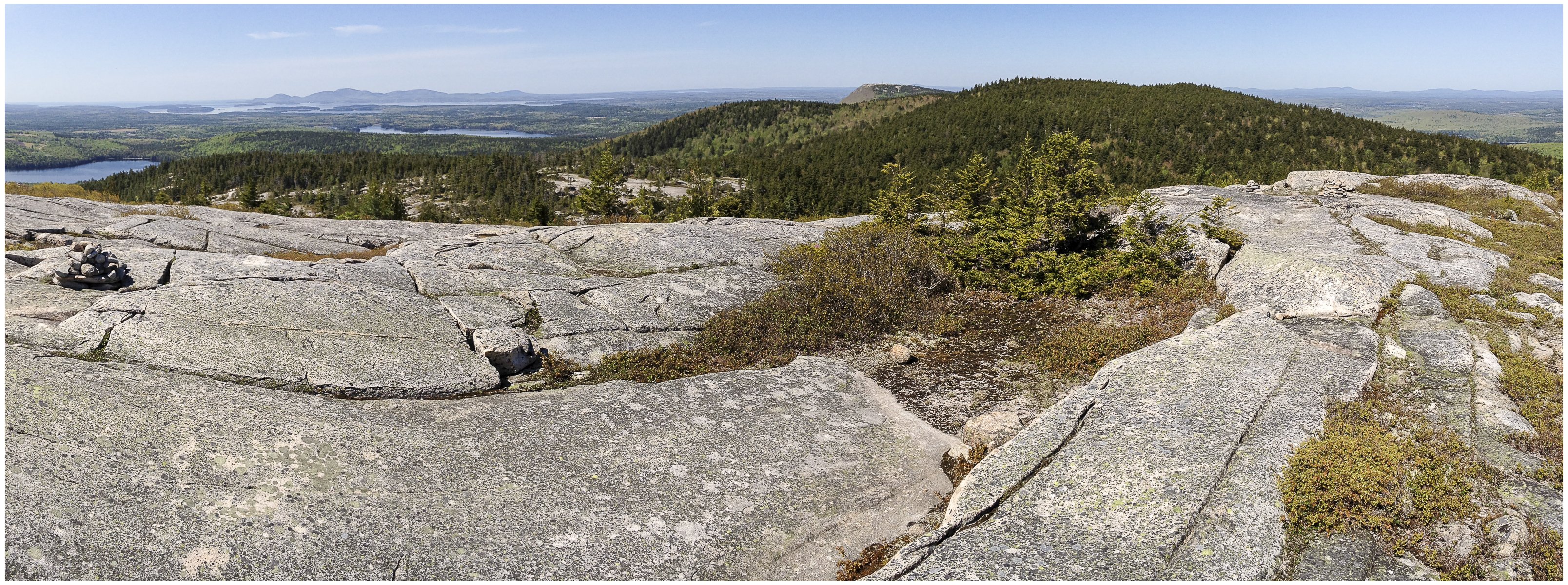
From here, we can also turn around and see the forested west peak of Black, and the bare summit of Schoodic Mountain (and in the distance, the Mountains of Acadia National Park):
SchoodicFromBlack
I was thinking I could run all the mountains in 3 hours, so I brought no water but did bring about a half dozen prunes and a few pecans to keep me from bonking.
Alas, I took 3 hours to get to the base of Schoodic Mountain, and by this time, the temperature was rising, and I was pretty much running out of steam. Managed to push to the summit and run slowly the rest of the 5km home from the summit. Legs were pretty beat today.

I’m glad I did this “run” but don’t think I’ll do it again, as it’s not really very runnable. The trail is pretty technical (rocks, roots) but too brushy to confidently see your footing ahead. Consequently, I could not really get into a running rythm. On the other hand, there’s over 1000 m of vertical in this 19km
section, so no matter what, your legs get a pretty good workout.

For trail runnning in DownEast Maine, it’s really hard to beat Acadia National Park on Mount Desert Island. Lots of vertical and nicely runnable trails.

Blueberry Barren, Franklin, ME

BlueberryBarrensFranklinME

At the top of the dead-end road is a blueberry field owned by my neighbor. The field is rented out to some (presumably) local blueberry farmer. I run by this field almost every day on my trail run up Schoodic Mountain. This morning I took our dog out for a few full-on sprints up to the top of the field, and was treated to a simply wonderful crisp, clear, vibrant spring morning.

As I walked along the top of the field, I just basked in the gorgeous views and of next thing I new I was composing photographs and thinking visually about the compositions I was mentally composing. So, I ran back home grabbed my camera, 40mm pancacke and a 70-200mm and spend some time making photographs.
BlueberryBarrensFranklinME01

BlueberryBarrensFranklinME02

Mount Desert Island from Schoodic Mountain

Went on a nice 13 km trail run with my sister-in-law Charlotte Clews (proprietor of Wild Open Heart Yoga). Ran up and over Schoodic Mountain and back to Franklin, ME. Finally the snow is gone most of the DownEast peaks, and normal crampon-free trail running can resume.
Charlotte’s photo was taken with her iPhone5.

If things work out, my family will be living on Peaks Island, ME this fall, in which case I’m really going to miss being able to run from my doorstep over five different mountain peaks. On the other hand, we’ll all be living together in one house, the White Mountains of New Hampshire won’t be more than 2 hours away (yeah), and the convenience of walking or running to work will be pretty sweet.

Mount Desert Island from Schoodic Mountain. Photo by Charlotte Clews.

Mount Desert Island from Schoodic Mountain. Photo by Charlotte Clews.

Next day, took my kids for a quick hike up Tunk Mountain on a gorgeous blue-sky day. Still chilly on top, but from the vantage point below, you can see Catherine, Caribou, Black and Schoodic Mountain. Click on either image for a larger version.

View ESE from Tunk Mountain.

View ESE from Tunk Mountain.

Peaks Island, ME

My family is beginning to search for a house on Peaks Island, ME so we can all be in one place, and I will be able to stop the insane amount of “commuting” I have been doing between DownEast Maine and Portland, being away from home for 4 days per week. Here are two snapshots in the evening before taking the ferry back to Portland after looking at a potential house.

In the image below, the posts are illuminated by the dock light (iso 1600, click on the image for a larger version)

Dock Posts, Peaks Island, ME

Dock Posts, Peaks Island, ME

And eventually, the ferry arrives (iso 1600); I just love the late evening and dock light combination in these two images.

Waiting for the Ferry, Peaks Island, ME

Waiting for the Ferry, Peaks Island, ME

As the last house didn’t pan out, the search continues. Meanwhile, I’m concertedly rehabbing some posterior tibial tendonitis and ankle pain that has totally stopped my trail running for 3 weeks now. But, I’m now regaining my normal flexibility, and am able to walk almost normally, so I am hopeful to be up running by the end of the week if things keep progressing along.

Perfect Camera for Trail Running: Any Recommendations?


The relative dearth of photos recently is a result of having become somewhat obsessed with trail running. I’ve never been a runner, but have done my share of distance touring, hiking, and swimming. Having decided that I don’t feel so safe bicycling on roads with swerving cell phone texting drivers, and because it takes at least 30 minutes to get to the nearest pool to swim, I decided to start running back in May 2012.

I don’t really like running on roads, but I absolutely love being in the mountains, so trail running was a natural for me. Mind you, I have never really run before aside one a very brief stint in graduate school when I ran for a few months. I say it was a “natural” but certainly not an easy progression to covering any significant distance without stopping. At first, I couldn’t even run up the first small hill (100 m) that starts 1 km from my house, and had to walk sections of a small 4 km loop. I would get totally out of breath and had to run and walk to complete the loop.

But, interestingly, once I let go of the judgement that walking was bad, it only took me about 5 tries till I could run the whole loop. Then I gradually began increasing distance, until an unfortunate night run when a previously rolled ankle decided to let me know that it had enough. It took 6 weeks of downtime when all I could do is cycle and swim to keep up the aerobic base. But come August, I’ve been able to run again, the longest run being a 20km run over on Mount Desert Island. Took me 3 hours and 4 gels, but it was a lot of fun.

I live in Franklin, Maine, in DownEast Maine, just bordering on the hopping town T10SD (which means Township 10 Southern Division, for those of you not familiar with this highly underpopulated part of Maine). There are five 300+ meter peaks in my backyard, and I’ve been working up to running all 5 in one go. I often go out on a run up Schoodic Mountain (that’s the peak in the above photograph)
or along the Sunrise Trail, and at this point, I’ve run the whole network of trails over all five peaks, and I’m ready to try a single end to end run that ends at my house.

What does this have to do with photography? Well, I still want to photograph, and since I run in places I normally would hike to in order to make images, I naturally want a camera that I can run with. My full-frame dslr is WAY too heavy to comfortably carrying while running, and I’m very interested in seeing what I can carry that still has outstanding image quality. The iPhone4s has a reasonable P&S camera, but it just doesn’t have the dynamic range and image quality that I wish it would. So, what camera would be easy to carry, yet have outstanding image quality?

View from Schoodic Mountain, Maine


So far, I have a few candidates, an Olympus Pen (the newer one with the OM-D Sony Sensor), Fuji XPro-1 (or wait for the XPRO 2?), or …well, I’m not sure what other cameras I should consider. Are there any trail runners out there with good suggestions?

I see two problems with this scheme. First, I’m already forgoing a tripod—something I’d never do with my dslr, and second, carrying anything goes against the whole minimalist simplicity I love about running. So, I’m somewhat puzzled, and cannot seem to come to any resolution, and I just keep running with my iPhone.

The eye of the beholder


This image is a photograph of an electron beam passing through low pressure mercury gas in a classic laboratory experiment performed by the physics majors at the University of Southern Maine. The electrons in the electron beam excite electrons in the Mercury atoms to higher energy levels (actually the beam is also likely ionizing most of the atoms, but I haven’t sat down to calculate whether this is in fact true), and then, as the mercury electrons cascade down to the ground state, they emit characteristic wavelengths of light, one of the brightest being the blue light at 435.835 nm that you see here. Those of you that have completed two semesters of physics should know why the beam is moving in a circle. The orange-red cylinder at the bottom left encloses a hot filiment from which the electrons are emitted.

All technicality aside, I really posted this image because I like what I see as its minimalist geometric design.

And knowing that I am looking at visual evidence of the passage of subatomic particles traversing a uniform magnetic field created by helmholtz coils only adds to my appreciation of the image, it doesn’t subtract from it.